Addressing Uncertainty in Flood Mapping from an Integrated Bayesian Model Perspective: A Real-World, Data-Limited Case Study
Resumo
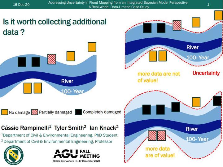
The determination of inundation extents by the development of flood hazard maps, including the frequency of floods, and how they affect flood-prone areas is a topic of paramount importance in water resources engineering. The procedure generally initiates by estimating the magnitude of a flood with a particular likelihood, followed by a simulation of that flood in a hydraulic model, ending in the delineation of the resulting flood extents in a flood map, typically represented as a deterministic boundary. However, neglecting uncertainty when delineating flood boundaries might result in some shortcomings in the use of mapped information considering different applications such as flood hazard and water resources management or even in river restoration planning. Additionally, addressing uncertainty can not only improve the decision-making process but also be instructive on the complementary data acquisition. This study applies a fully Bayesian model capable of integrating the uncertainties from the rating curve and flood frequency analysis to generate flood maps using the HEC-RAS hydraulic model to propagate the uncertainties in the water surface elevations. The model is tested in a practical real-world case with limited data. The flood maps for different return periods, including the 95% credible intervals, are generated. The results demonstrate that even in situations that suffer data limitations, uncertainty analysis can still be useful to better inform decision making.